Mayo is Richest Irish Wetland County
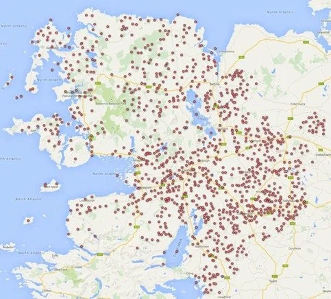
As part of the project to map Ireland's wetlands, a preliminary mapping project of all wetlands (both known and potential wetland sites) in County Mayo has just been completed. Not surprisingly, for the third largest Irish county covering 5,585 square kilometers (after Cork and Galway), and with a reputation for being one of the wetter western counties, a total of 1116 wetland sites have been identified in the county. This makes Co. Mayo the record holder for wetlands in Ireland to date. It only remains to be seen if more wetlands occur in Galway when this is finally analysed as part of the on-going mapping project.
The wetland sites mapped in Mayo are those which have been reported in wide range of published sources, and previously unknown sites located through an aerial photographic analysis combined with sub soils data.
Prior to this research project 157 wetland sites had been recognised within the county, many of them larger blanket bog areas located in the western part of County Mayo. This project has located an additional 956 wetland sites throughout the county, bringing the total number to sites recorded to 1116. Wetlands included on the map are areas of raised, upland and lowland blanket bog, fen, swamp, wet woodland, salt marsh, lakes, rivers and coastal saltmarsh and lagoons.
The majority of the “new” sites identified have limited associated information on the wetland habitats that are likely to occur on the sites. County wetland surveys are required to address this information deficit.
The Wetland Map of Ireland now displays a total of 7,511 wetland sites for Ireland.

