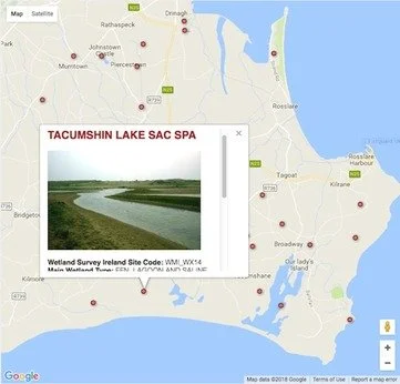
Revised County Wexford Wetland Map
As part of project to map Ireland's wetlands – the Map of Irish Wetlands - has published a revised County Wexford wetland map. The new on-line map has been uploaded and can be viewed on the Google map platform through Foss Environmental Consulting and Wetland Surveys Ireland website.
A variety of additional wetland locations, site descriptions and photographic images for the wetlands in Wexford county are shown on the new map.
Here are some facts about the revised Wexford Wetland Map:
The location of 321 known and potential wetland sites are shown in County Wexford.
No wetland survey has been undertaken for the majority of these sites in County Wexford.
60 sites on the Wexford wetland map display a photograph of the wetland.
All wetland sites listed in Wexford display information on the wetland habitats that are known or likely to occur there.
57 wetland sites include a short description of the wetland interest on the site.
To explore the map and obtain further information on the Map of Irish Wetlands project check out this link.
The Wetland Surveys Ireland Team hope you enjoy your tour of wetlands in Wexford !

