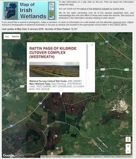
Update of the Map of Irish Wetlands 2018
As part of the joint project to map Ireland's wetlands, with Foss Environmental Consulting, a revised Map of Irish Wetlands for the entire country has just been uploaded to the Google map platform. A variety of new data sources, site descriptions and photographic images for the wetlands shown has been included in the 2018 revised map.
The location of 12,731 wetland sites are shown on the Map of Irish Wetlands, together with information on known and potential wetland habitats on these sites.
4,065 wetland sites are now illustrated with site photographs.
3,753 wetland sites include a summary description based on surveys and reports.
Further background information on the Map of Irish Wetlands project can be found here.
During 2018 we hope to further refine and expand the information on wetlands displayed on the Map of Irish Wetlands, and welcome your information and photographs for the wetlands shown on the map.

