Ireland’s Fabulous Fens
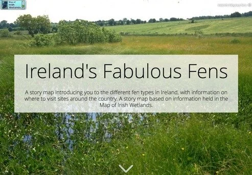
At Wetland Surveys Ireland and Foss Environmental Consulting we have been surveying, studying and researching fen habitats throughout Ireland for over twenty years. We have recently developed a story map to share some of our fascination with these wonderful Irish wetlands. The map is a compilation of stunning images taken from Irish fens giving you an insight into this lesser known and rarely seen part of the Irish landscape.
Fens are a unique type of peatland that form an important part of the Irish landscape. They help regulate and clean our water supply, support a rich variety of wild plants and animals, and can even tell us about our past history. With so much in their favour, it is surprising that fens are one of the least studied and lesser known Irish habitats.
The story map brings you on an informative tour focusing on four main themes;
Background to fen habitats where you can learn of their origin, development, and ecology
Biodiversity value of fens and the various plant and animal species they support
The importance of conserving Irish Fens
Fen sites to visit in your locality many of which are open to the public with various facilities
Ireland’s Fabulous Fens story map was created by Dr Peter Foss as part of the Map of Irish Wetlands project. To learn more about Irish fens and see the spectacular images click on the following link:
Footnote:
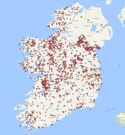
Distribution map of fens in Ireland based on data help in the Map of Irish Wetlands.
Additional information on the abundance of the different known and potential fen types in Ireland based on data help within the Map of Irish Wetlands.
Fen type & Number of known and potential sites identified in the Map of Irish Wetlands:
Alkaline fen 659
Cladium fen 196
Transition Mire 541
Poor Fen 643
Calcareous springs 222
Non-Calcareous springs 45
(Note: a fen site can contain more than one fen type)
Information for the wetlands included in the story map comes from information held in the Map of Irish Wetlands. The Map of Irish Wetlands has been created by Dr Peter Foss and Dr Patrick Crushell and shows the location of more than 12,600 wetland sites in Ireland. The map has been developed and made available to the public free of charge.
If you would like to visit some other wetland you can check out the story map Wetlands to Visit Around Ireland. The story map brings you on an informative tour of 40 wetlands around Ireland where you can learn more about these fascinating habitats.
Link to 'Wetlands to Visit Around Ireland' story map:


