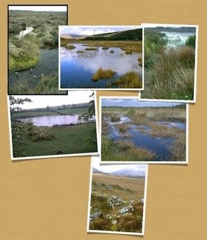
Put your wetland photograph on the Map of Irish Wetlands
The Map of Irish Wetlands contains 2,200 wetlands which display a photograph of the site in question on the pop up information window. These images have been kindly supplied by a variety of organisations, local groups and individuals, who are acknowledged in the pop up window. But with over 12,500 sites in total displayed on the Map of Irish Wetlands, there are still many wetlands without a photograph.
We are hoping that this is where you might be able to help us!
If you have a photograph of a wetland in your area, or that you recently visited, why not have it included on the Map of Irish Wetlands? Or perhaps take a snap shot on a mobile device when your out and about, maybe of a local wetland close to you that is not illustrated at present. You can send on your digital photograph by email to peterjfoss@gmail.com.
If possible please include the Wetland Map site code to make sure we know which site you are referring to.
All photographs submitted for inclusion on the Map of Irish Wetlands are listed as copyright of the photographer and you will be acknowledged on the Map of Irish Wetlands.
Your images need be no bigger than 200-300 Kb when u email it to us.
By sending an image you agree to our use of the image on the Map of Irish Wetlands. Remember if you would like to be acknowledged, send us your name otherwise the photograph will be attributed as “Anonymous”.
So check out the wetland map for your locality, and get out there and take a snap shot of a wetland in your area... your local park... on your favourite wildlife walking route…. on your farm … or your local golf course… wherever !
We look forward to hearing from you, and thanks for supporting the Map of Irish Wetlands project.
Peter Foss & Patrick Crushell

