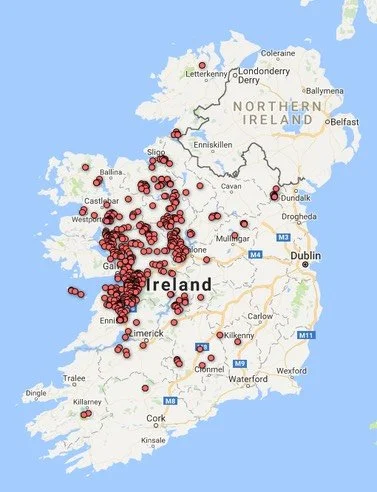
Wetland habitat distribution maps for Ireland
Following upload of the County Galway wetland dataset for the Wetland Map of Ireland in September 2016 it is now possible to show provisional wetland habitat distribution maps (based on the known and possible occurrence of different wetland types) throughout Ireland. The map examples below shows the distribution of Cladium fen and Turlough sites throughout the country. The maps should be regarded as the minimum distribution for each habitat type in the country, with future surveys likely to reveal additional sites for the different wetland habitat types.
Distribution of Turloughs in Ireland based on the Map of Irish Wetlands 2016
Distribution of Cladium fen in Ireland based on the map of Irish Wetlands 2016
Further examples of selected wetland habitat maps based on the Map of Irish wetlands can be viewed here.


